To travel to Hong Kong is to move between compression and release: a tram squeezed through towers, then a ridge opening above the sea; a crowded dining room, then the wide breath of a ferry crossing. This page is the vertical-city route inside our Chinese cities travel guide.
Travel to Hong Kong on its own terms
Hong Kong belongs to the wider Chinese cultural world, but it is not a smaller version of a mainland city. Cantonese language and food, British colonial history, migration, cinema, finance and dense public transport have produced a specific urban identity.
Treating it only as a skyline misses the intelligence of its ordinary systems. Markets, housing estates, footbridges, ferries and cha chaan teng dining rooms show how limited land and intense movement become daily culture.
Who should visit Hong Kong
It is ideal for travelers who want food, film memory, design, hiking and a global city that can change scale within an hour. English is widely visible, though Cantonese remains central to local life.
Hong Kong rewards early mornings and late evenings. The midday shopping itinerary is the least interesting version of the place.
| Hong Kong at a glance | What it means for your trip |
|---|---|
| Best for | Cantonese food, film, visual culture, hiking and dense urban life |
| Ideal first stay | Three to five days |
| City pace | Fast, compressed and highly connected |
| Best way to move | MTR, tram, ferry and walking in short vertical sections |
| Do not miss | One harbor crossing and one route into the hills or islands |
Choose your route through this guide
| If you need... | Start with... |
|---|---|
| A first itinerary | Harbor geography and the three-day sequence |
| Neighborhood life | Kowloon markets, housing density and street-level transport |
| Nature | Weather, route grading and the city-to-trail transition |
| Food | Cha chaan teng, dim sum and meal timing |
| Border logistics | Currency, Octopus, airport and mainland connections |
Geography is vertical, maritime and fragmented
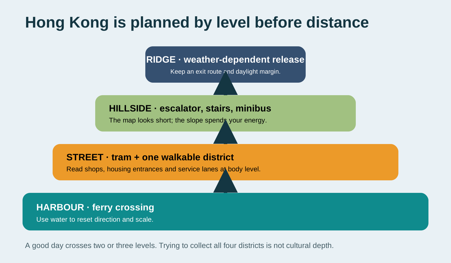
Hong Kong is compact on a regional map but physically complex. Water separates major districts, mountains force roads and rail into corridors, and everyday movement often shifts among street, footbridge, escalator, station and hillside path. A destination 800 meters away may sit several levels above you or on the other side of an uncrossable road.
Plan by territory. Give northern Hong Kong Island one coherent route through Central, Sheung Wan, Wan Chai or Causeway Bay. Give Kowloon a separate route through Tsim Sha Tsui, Jordan, Yau Ma Tei, Mong Kok or Sham Shui Po. Treat the New Territories, Lantau and outer islands as distinct landscape days rather than spare afternoons.
The harbor is not empty space between the interesting parts. It explains orientation, weather, trade, defense, reclamation and the emotional separation between Island and Kowloon. Cross it at least twice in different light.
Reclamation changes what "waterfront" means
Much of the current shoreline is engineered and repeatedly extended. Promenades, cultural districts and roads can sit far from earlier coastlines. Do not assume that an old building's current distance from the water reflects its original relationship to the harbor.
Walk one continuous waterfront section and notice where public access is generous, where infrastructure interrupts it and where major institutions use the reclaimed edge. This produces a more useful understanding than collecting skyline views from disconnected observation points.
The MTR compresses time but can hide the territory
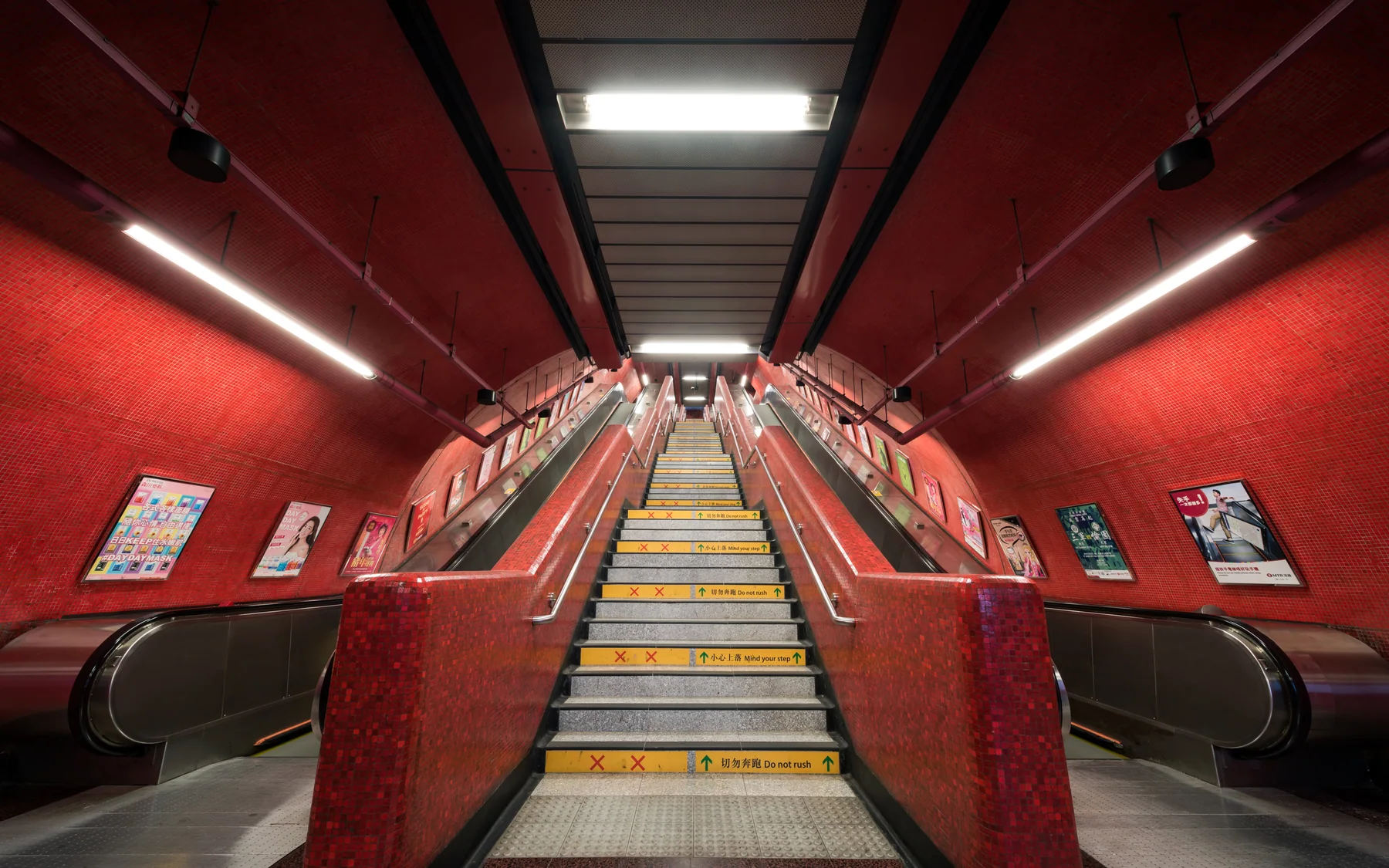
Hong Kong's rail system makes distant districts feel adjacent. That efficiency is valuable, but it can produce an itinerary that repeatedly disappears underground and reappears at famous exits without understanding the land between them. Use the MTR for long transfers, then select one tram, ferry, bus or walking segment that reveals slope, shoreline and housing.
Station names also describe large internal environments. The correct exit may require a long corridor, multiple levels or a connection through a commercial building. Save the exit letter, then check which street level it reaches. When carrying luggage or traveling with limited mobility, “next to the station” is incomplete information.
A good first-day movement sequence is deliberately mixed: walk through one neighborhood, ride the tram long enough to understand the street canyon, cross the harbor by ferry and return by MTR. The modes are not attractions to collect. Together they explain why dense settlement remains usable.
Essential Hong Kong experiences
Cross Victoria Harbour slowly
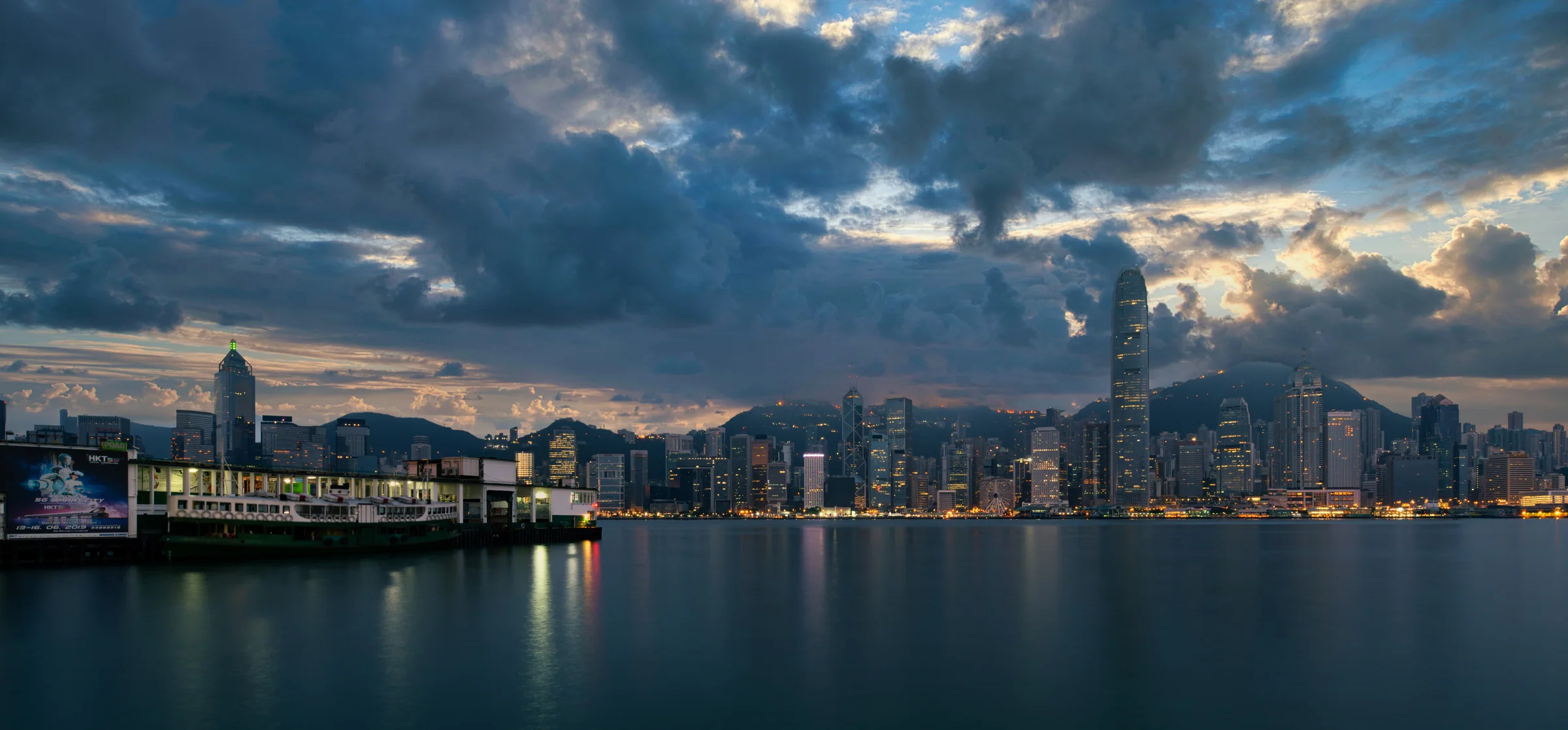
The Star Ferry is not merely a cheap attraction. It preserves a bodily understanding of the harbor: wind, distance, changing light and the relationship between Kowloon and Hong Kong Island.
Ride in daylight first. Watch piers, working vessels, promenades and mountain profiles change as the ferry turns. A night crossing adds the illuminated image but removes some geographic detail. Both are worthwhile because Hong Kong's identity is partly built through repeated crossings.
Do not confuse the short crossing with the full transport journey. Reaching the pier, waiting, boarding and continuing uphill on the other side can take longer than the vessel ride. That inconvenience is also what makes the ferry reveal the city differently from the MTR.
Ride at street level
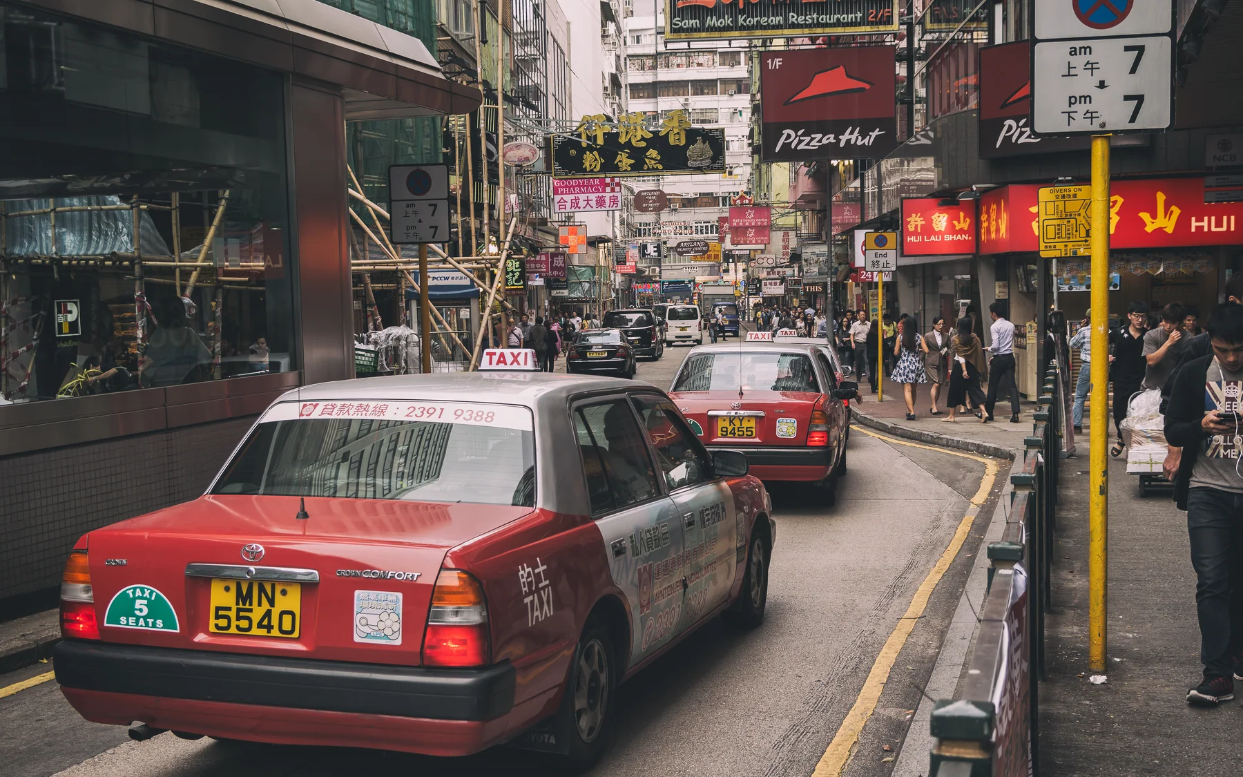
Take a tram through the northern side of Hong Kong Island, then walk. Central's vertical walkways, Sheung Wan's older businesses and Sham Shui Po's street texture each reveal different economies.
The tram is slow enough for urban reading. Sit upstairs when available, but do not treat the route as a sightseeing bus that should deliver an uninterrupted view. Air conditioners, signs, scaffolding, buses and close facades are the real streetscape.
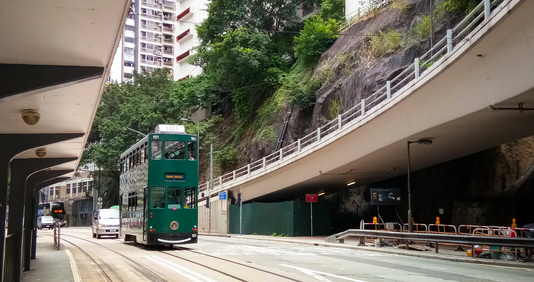
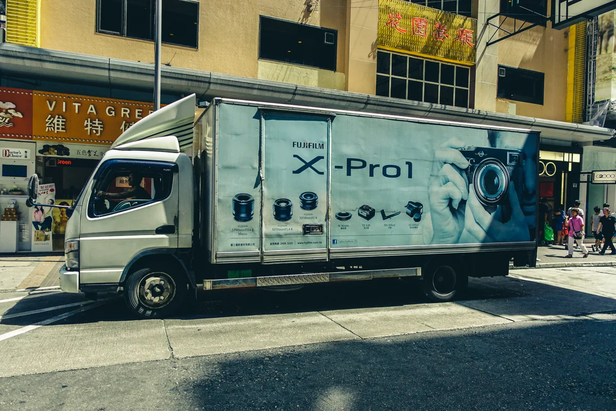
This is why I prefer one tram ride to another observation deck. The frame shows grade, retaining wall, flyover and rail sharing one narrow corridor: Hong Kong's vertical geography is not an abstract skyline fact; it reaches the street and decides how the vehicle moves.
This street-level view is the reason I insist on one tram segment. The rails, taxis, buses, shop fronts and rooms above them remain legible in a single frame. The MTR gives Hong Kong speed; the tram gives that speed a visible price—constant negotiation for the same strip of road. Stay aboard for several stops, then walk part of the route back. Recognition turns a moving spectacle into a neighborhood.
Density is a housing condition, not an aesthetic
Hong Kong's towers create dramatic photographs because repetition and mountain backdrops compress enormous scale. Those buildings are also homes shaped by land prices, household needs, transport access and public policy. Photograph architecture from public space without aiming into individual apartments.
Quarry Bay and other dense districts are often circulated online as visual spectacles. Visit only where public access is unambiguous, keep circulation clear and remember that residents are not components in a cyberpunk scene. The more extraordinary the image appears, the more careful the caption should be.
Public estates, private towers, village houses and luxury developments all belong to Hong Kong. One famous dense courtyard cannot represent the entire housing system.
Leave the skyline
Choose a hike, beach, island or country-park route appropriate to weather and fitness. Carry water and sun protection. Hong Kong's green geography is not an escape from the real city; it is part of how the territory works.
Choose the route by exposure, elevation, transport and exit options, not only by the final viewpoint. Humidity and sun can make a modest trail physically serious. Rain turns stone and concrete paths slippery, while storms and heat warnings require a complete change of plan.
An island or Lantau day offers a different relationship among settlement, religion, transport and landscape. The Tian Tan Buddha and Ngong Ping are major visitor environments rather than remote discoveries; combine them with realistic cable-car, bus and weather planning.
Nature is most revealing at the transition point. A bus can leave dense housing and reach a trailhead quickly, but the route may still overlook reservoirs, villages, beaches and infrastructure supporting the city. Keep those systems in the story.
A nature day must include an exit plan
Choose the return route before beginning a trail. Some routes finish at a road with infrequent transport, while ferries and island buses may have long gaps or queues. Save the Chinese destination name, last practical connection and an alternative exit offline. A trail that looks short in an app can become a much longer day once heat, stairs and waiting are included.
Do not use a tropical-cyclone, thunderstorm or extreme-heat warning as dramatic atmosphere. Follow official instructions and move the day indoors. Hong Kong has enough museums, cinemas, covered markets, long meals and transport-based urban observation to support a complete weather alternative. Flexibility is not a concession; it is part of traveling responsibly in a maritime climate.
Beaches and country parks are public landscapes, not empty scenery. Carry out waste, keep speakers quiet, avoid wildlife feeding and respect village paths. The ease of reaching green space from a tower district is one of Hong Kong's defining achievements, but ease of access does not make the landscape disposable.
Follow cultural memory
Film locations, music, neon-sign craft, contemporary art and changing neighborhood businesses make Hong Kong's cultural influence visible. Approach nostalgia carefully: the city is lived in the present, not preserved for someone else's cinematic memory.
A location associated with a film may have changed use, signage or entire street context. Photograph the current place first, then explain the screen memory. Re-creating an old frame is enjoyable, but it should not require blocking a shop or treating workers as extras.
The strongest film route is therefore not a scavenger hunt. Read the Hong Kong culture guide before choosing a location, then ask what the present place still does. A working counter, corridor or escalator deserves attention because it organizes daily life, not because it resembles a frozen screen grab. The Wong Kar Wai guide explains how crowded routes produce wrong timing; the Chungking Express guide shows why a food stand and apartment carry more emotional evidence than a skyline montage.
I would choose one living place and stay long enough to notice its current rhythm. That is more honest—and more memorable—than racing through six coordinates for six imitation photographs. If a business is busy, buy something, wait your turn and keep the camera away from faces. The city is not withholding a movie from you; it is continuing after the credits.
Neon remains culturally powerful even as safety rules, LEDs and redevelopment change the night streets. Look at typography, scale and commercial purpose rather than counting surviving signs as endangered objects detached from business life.
Young Hong Kong: visual culture after the famous skyline
Hong Kong has exported images of itself for decades through cinema, Cantopop, graphic design, fashion and advertising. Younger creators inherit that visual confidence while working inside a city transformed by new platforms, high costs and shifting regional connections.
M+ in the West Kowloon Cultural District provides a serious entry into modern and contemporary visual culture, design, architecture and moving image. It is especially useful for an overseas visitor because it places Hong Kong and wider Asian cultural production inside a global conversation without treating Asia as an appendix.
Beyond institutions, look for current film screenings, small exhibitions, live music, zine and design events. Do not build a trip around an old list of independent venues; Hong Kong's creative spaces change quickly.
See Hong Kong as a producer of culture
| Form | What to explore |
|---|---|
| Film | Repertory screenings, local releases and locations understood beyond nostalgia |
| Music | Cantopop history alongside current independent and cross-border scenes |
| Design | Typography, transit graphics, product design and adaptive small spaces |
| Moving image | Museum programs, advertising memory, social video and digital art |
West Kowloon changes the cultural map
M+, the Hong Kong Palace Museum, performance venues and waterfront public space concentrate major institutions on reclaimed land. The district deserves enough time for one museum and a long exterior walk; trying to complete every institution in one day produces cultural fatigue.
Look back toward Hong Kong Island from this newer waterfront. The view connects museum development, infrastructure and the global skyline, making the cultural district part of an urban-planning story rather than an isolated collection of buildings.
Street commerce is working life before night photography
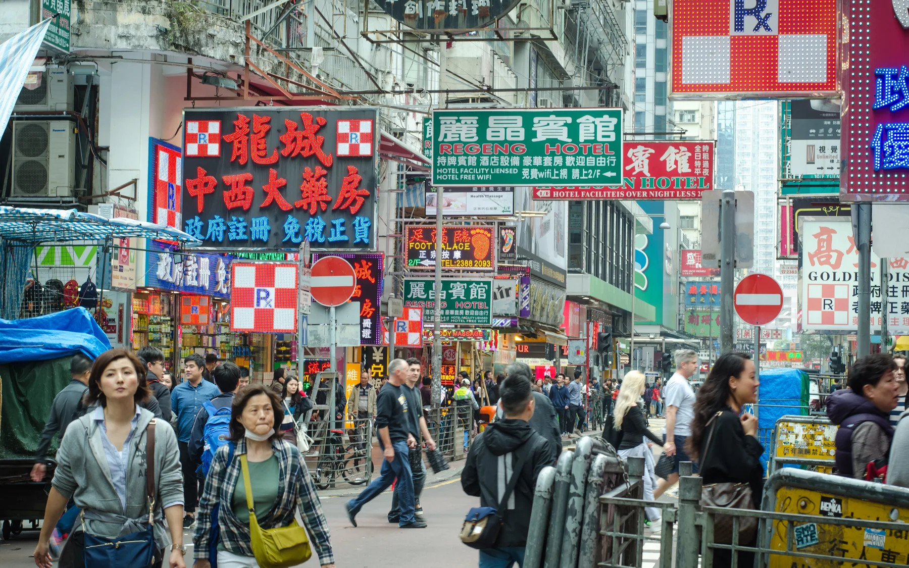
Temple Street, Mong Kok and Sham Shui Po contain different mixes of food, retail, repair, wholesale and visitor trade. Schedules and specialties change. Walk once before photographing, stay out of transactions and do not assume every stall welcomes close video.
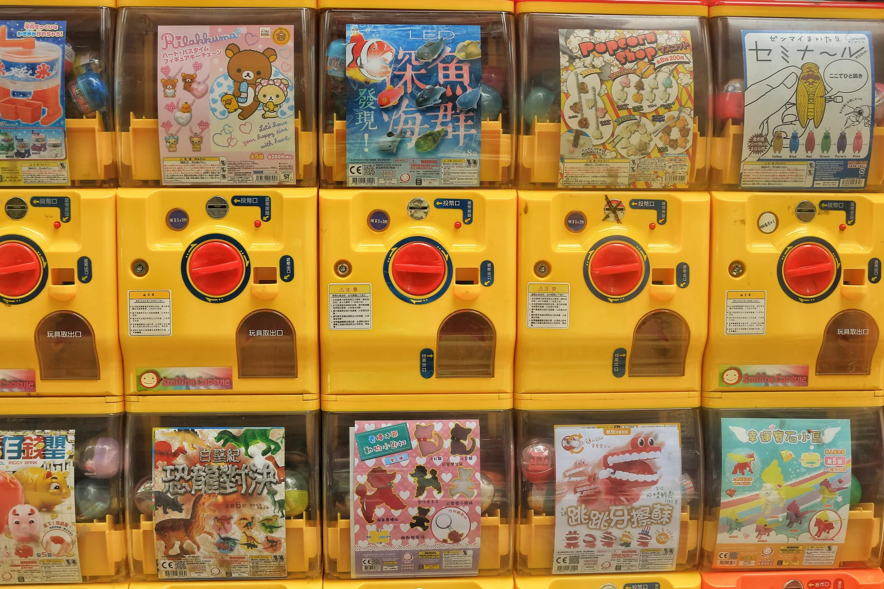
Even this wall of capsule-toy machines carries the point that neon-only guides erase. Hong Kong retail repeatedly compresses stock, choice and play into frontage measured in a few steps. It does not prove what every market sells; it proves that small urban space can still be made commercially intense. In a working market, stand at the edge before entering, notice where deliveries and residents need to pass, and never turn the busiest aisle into your portrait studio.
The night market is only one urban hour. Return to a Kowloon district in daylight to see deliveries, schools, medicine shops, electronics and household commerce. The contrast prevents neon from becoming the entire story.
Hong Kong is a system of transitions
What most guides get wrong
They move among Peak, skyline, market and dim sum as separate icons. Hong Kong's originality lies in the connection: escalators link steep neighborhoods, ferries make water into public transport, housing rises beside trails and small dining rooms serve a city moving at extraordinary speed.
Three days can introduce the system. Five days allow weather flexibility, one substantial landscape route and repeat visits to neighborhoods after they become recognizable. The extra time should not be spent adding more observation decks.
The territory is best for travelers comfortable with density, queues, small rooms and changing levels. It can be tiring for anyone with limited mobility unless routes are researched carefully. Excellent transport reduces distance, but it does not remove stairs, slopes or long station interchanges.
The East Moment recommendation is to let every day cross one boundary: Island to Kowloon, street to hillside, market to museum or cinema memory to the present location. That pattern creates a coherent Hong Kong without pretending that one district represents the whole territory. Repeating a ferry or tram route is valuable because recognition replaces the anxiety of navigation and leaves more attention for people, language and use.
What to eat in Hong Kong
Dim sum, wonton noodles, roast meats, congee, egg tarts and milk tea offer only the first layer. Try a cha chaan teng breakfast, a neighborhood noodle shop and a Cantonese shared dinner. Queue behavior, table sharing and brisk service are part of the rhythm, not signs of hostility.
Our Hong Kong food guide provides more context without pretending one restaurant can permanently represent a changing city.
Plan food by institution as well as dish. A cha chaan teng has a different rhythm from a dim-sum hall, roast-meat counter, dai pai dong-style setting or formal Cantonese restaurant. Service can be brief because tables turn quickly; decide before sitting and ask concise questions.
Milk tea and yuanyang belong to workday energy as much as culinary tourism. Wonton noodles emphasize broth, shrimp filling and texture in a compact meal. Roast goose or char siu can be ordered by portion, while clay-pot rice requires more time and may be seasonal or evening-focused.
Queues reflect capacity, media attention and timing as well as quality. A famous line is not automatically a cultural obligation. Keep a backup within the same neighborhood instead of crossing the territory because one shop sold out.
A three-day Hong Kong itinerary
| Day | Morning | Afternoon | Evening |
|---|---|---|---|
| 1 | Central, Sheung Wan and tram ride | Peak or hillside walk | Ferry to Kowloon and harbor lights |
| 2 | Kowloon market districts | Museum or design neighborhood | Cantonese dinner and Mong Kok streets |
| 3 | Hike, island or beach | Return slowly by ferry or bus | Cha chaan teng or neighborhood meal |
A stronger five-day sequence
- Central and Sheung Wan at street level, Peak only if visibility supports it, then ferry to Kowloon.
- Kowloon markets and neighborhood commerce, followed by one West Kowloon institution.
- A hike or country-park route selected for weather and fitness.
- Tram-based Hong Kong Island neighborhoods, design or film culture and a shared Cantonese dinner.
- Lantau, an outer island or a repeat neighborhood day chosen after learning the transport system.
Where to stay
Central and Admiralty favor business, major transport and Hong Kong Island landmarks, usually at higher cost. Sheung Wan and Wan Chai provide strong street-level access with different evening characters. Tsim Sha Tsui is efficient for harbor views and Kowloon transport but intensely visitor-facing. Jordan, Yau Ma Tei and Mong Kok place food and street commerce closer to the hotel, with smaller rooms and more noise.
Choose the exact MTR exit and airport route. Two hotels described as five minutes from the same station can differ sharply because of footbridges, slopes and the number of internal station corridors.
Practical Hong Kong travel
The MTR is excellent, but walking often involves slopes, stairs and elevated connections. An Octopus card is widely useful across transport and everyday purchases. Hong Kong uses the Hong Kong dollar, drives on the left and maintains border arrangements distinct from mainland China and Macau.
Check current entry rules for your passport and route. Our Travel to China guide explains the wider journey while preserving these distinctions.
Weather planning is essential. Summer heat, humidity, heavy rain and tropical cyclones can close trails, ferries or attractions. Autumn often provides the easiest combination of visibility and walking comfort, while winter can be cool and windy on exposed ridges. Spring humidity and low cloud can erase famous views.
Do not schedule the Peak as a fixed promise. Check visibility and move it to another day when possible. The harbor, street transport and neighborhood routes remain meaningful without a clear skyline.
Mainland China, Macau and Hong Kong use different entry systems and currencies. A rail or bridge connection does not remove border formalities. Confirm documents, tickets and re-entry conditions for the complete route rather than treating Hong Kong as a domestic side trip.
Macau, Shenzhen and Guangzhou are not casual add-ons
Fast rail, ferries and the Hong Kong-Zhuhai-Macau Bridge make regional movement visible, but transport speed is only one part of the decision. Immigration, station access, ticket timing, currency, mobile connectivity and the return route can consume the flexibility that made the Hong Kong stay work.
Use Macau for Portuguese-Chinese urban layering, not as a casino photo stop. Use Guangzhou for a deeper Cantonese trade and food context. Shenzhen makes sense for contemporary urbanism and technology interests. Each deserves its own question and preferably an overnight; none should be added solely because the map shows a short line.
Airport day also requires restraint. Hong Kong International Airport is well connected, yet hotel checkout, transport, terminal procedures and possible weather disruption still need margin. Do not attach an island ferry or remote hike to a same-day international departure. Keep the final route urban, reversible and connected to luggage.
Frequently asked questions about travel to Hong Kong
How many days do I need in Hong Kong?
Three full days can combine Hong Kong Island, Kowloon, harbor travel and one hike or outer-island experience. Five days allows the city to feel less like a series of viewpoints.
Can I use mainland Chinese payment and transport assumptions in Hong Kong?
No. Hong Kong has its own currency, border procedures, transport system and payment habits. Check current entry requirements and prepare specifically for Hong Kong.
Is Hong Kong only a city destination?
No. Country parks, beaches, islands and mountain trails occupy a substantial part of the territory and can be reached from dense urban districts surprisingly quickly.